
"Hello" to those of you who are stopping by Sweet Southern Days today. On the Blogger.com site I can see the country from where you may be visiting Sweet Southern Days during any particular week. I am happy to see this week there are visitors from the United States, and a lot of visitors from Poland, France and Italy. Also, some of you are visiting from the Ukraine, United Kingdom, Canada, Germany and Romania. I LOVE that we can connect and visit together if only in this small way.
I hope you will come along with us today as we again visit the Great Smoky Mountains National Park. This time we travel down a narrow and interesting out-of-the-way roadway that we have never visited before. It was a fun adventure and we do hope you come along with us.

I found the below map on the internet and was hoping to show you exactly where this interesting roadway is located, but the map does not show up very sharp, however you may be able to get somewhat of an idea.
If you are ever in this North Carolina/Tennessee area and have time to visit, you would really love to see this beautiful park, which is highlighted in light green, in the below photo.
On this day, we drove through the middle of the park, highlighted in red (Highway 441) and on to the turn-off to the Cades Cove area seen at the top of the map to the far left.

We have visited the Cades Cove area previously, and I had my camera to try to capture some of the beauty of this old historical area. If you would like to see that particular Blog Post just click on the link below.

As you drive through Cades Cove you can make a loop and come back where you started from. Or, at about the half-way point of the Loop, we were told there is a very primitive roadway called Parson Branch Road leading out of the park that would intersect with Highway 129.
If you look at the above map you can see Parson Branch Road leading away and down from the Visitors Center at the far left of the map. It is the last black line on the extreme left side of the map.
Fall is a very popular time of year to be visiting this area. As you can see in the below photos, cars were bumper to bumper. But, that was OK with us because we were able to inch along and enjoy the beauty all around us.

Amazingly, Smoky Mountains National Park is reported to have ten million visitors a year.
After visiting this beautiful area I can definitely see why.


As we inched along in traffic we passed by this cute black bear in the below photo busy eating what looked like a crunchy pine cone. He was totally enjoying himself and paid no attention to the cars passing by him. He was black so it is hard to see many details and I definitely was not going to get out of the car for a close-up.

In the below photo you can get an idea of why these mountains are called the Smoky Mountains.

As you can see Fall has come to Cades Cove.


In the below photo we see the beautiful valley that runs through the Cove.

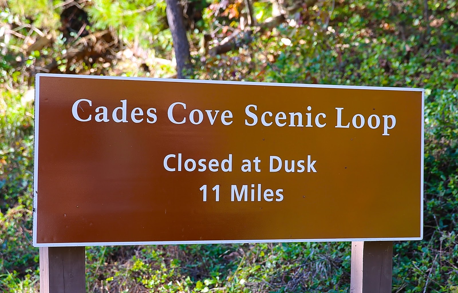
At this point we had reached the halfway point of the Cades Cove Loop, and we see the sign pointing to Parson Branch Road. We could have continued on around the Loop, but no, we definitely wanted to drive along and see what was called a very primitive roadway.

So here we go ... Looking for Parson Branch Road.

Not too far down the gravel road we pass this very old cabin seen in the below photo.

According to what we could find out, this cabin was built by Henry Whitehead in 1895.
He was a widower with three daughters.


If you look closely at the bottom photo you will see a much smaller cabin located in the back. This smaller cabin belonged to Matilda Shields whose first husband left her alone with a small child. Her brothers quickly built this very small cabin for her when her husband deserted her.
When Henry met Matilda he courted and married her and built what was considered a Smoky Mountain dream home at the time. The new "dream home" was attached to the original tiny cabin seen in the back. I love this sweet, happy ending.

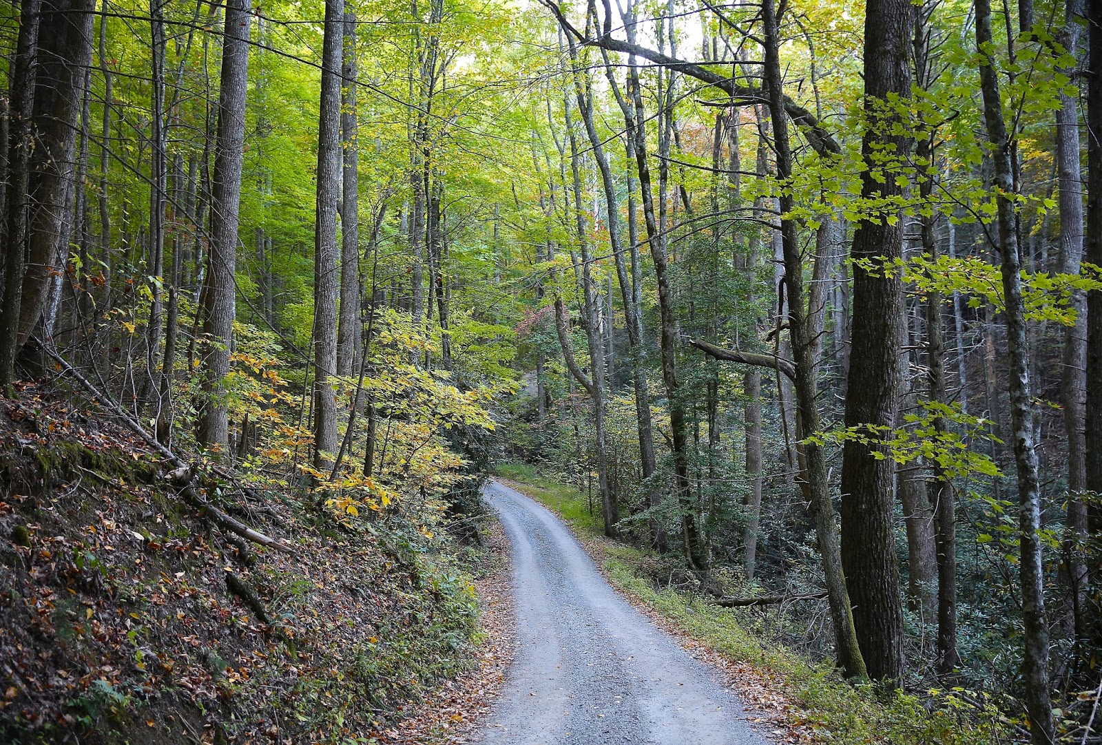
Traveling a short distance from the Whitehead Cabin we see the beginning of Parson Branch Road.


Looking to the side we see this pretty, peaceful creek.

Parson Branch Roadway looked safe to us.

Oooh! Then we saw this sign!

But, that was OK, it still looked pretty safe to us.
And, I love a bend in the road and wondering what is up ahead and around the curve.

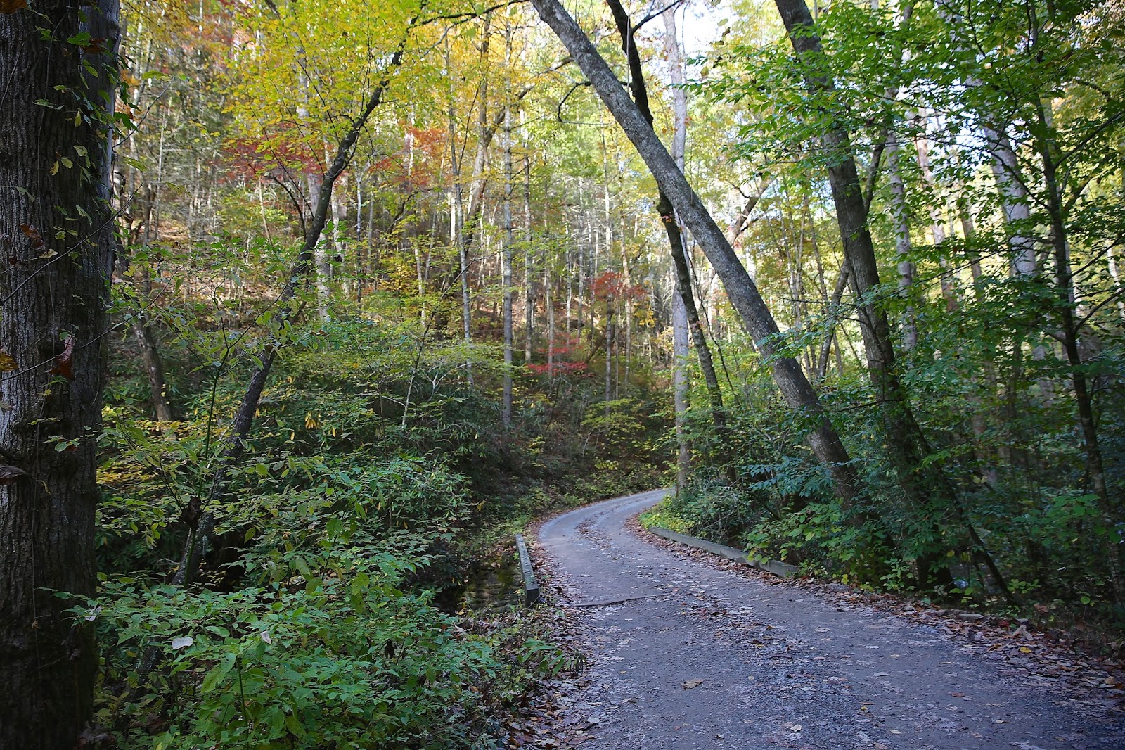
Turns out there were lots and lots of bends in the roadway as we traveled along for this eight miles.

And, lots of Fall color.

We kept looking for wild creatures as we drove along.

We were told to be on the look out for possible sightings of bears, turkey, deer and wild boars.
All of the creatures must have been napping because we did not
see anything, not even a bird flying by.


There were several creeks crossing the road as we drove along.

The creek dropped off into a very small little waterfall.
How pretty with the Fall leaves drifting along.

So far we felt perfectly safe as we drove along. This stretch of roadway is a one-way gravel road.
So, if you decide to turn back, that is not possible.

This unpaved road was previously a wagon track that has been used for more than 150 years. We were told the road was used by Parsons or Ministers to travel to and from Cades Cove. But, some say it may have been named after Joshua Parson who was an early settler in the area.


And we pass another creek with a larger waterfall ... so peaceful!
There are a lot of huge rhododendron bushes all along the way.
They must be beautiful in June when they are in bloom.

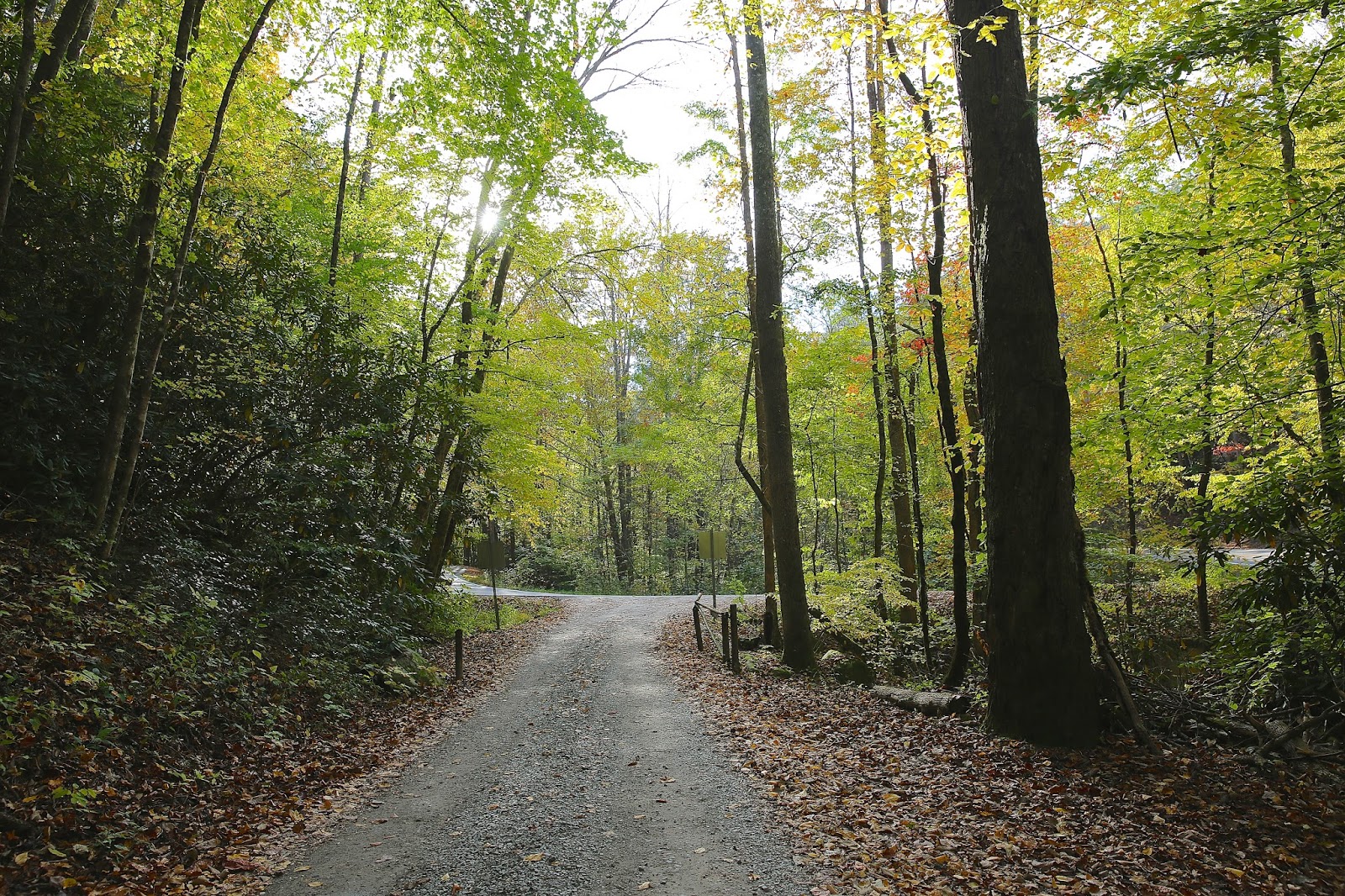
According to our calculations at this point we have almost reached the eight mild mark.
It was so pretty to see this creek with the mini waterfall as we drove along.


And then we rounded the last bend in the road, there it was....the end of Parson Branch Road!!
There are gates at the beginning and end of this road so the Park Rangers can close off the road if need be. We were told they close the road if there are heavy rains or stormy conditions. Also, the road is not open year round.
The road opens April 10th and closes November 15. Buses and motor homes are not permitted on Parson Branch Road.

It was delightful to drive this road with no problems what-so-ever.
We did not encounter another car all along the drive
except when I got out of the car to take photos of the end of the
roadway another car pulled up behind us. So, even though we thought we
were all alone out there, there was another car not too far behind us.

We have arrived at the end of Parson Branch Road which intersects the famous Highway 129, more so known as the "Tail of the Dragon." And, as always, there were lots of motorcycles on the road.


Leaving Parson Branch Road we turned left onto the Tail of the Dragon or Highway 129
and headed back toward our cabin in Robbinsville.

If you would like to see a previous Blog Post telling about the
"Tail of the Dragon" you can click on the link below:
sweetsoutherndays.blogspot.com/2013/11/tail-of-dragon.html

It was a pretty drive heading back toward the cabin and seeing all the Fall leaves along the way.


Thanks so much for stopping by for a visit. I surely do hope you enjoyed driving along with us down the quiet and peaceful Parson Branch Road.
As we begin the second week of November I do wish you a wonderful week with many blessings wherever you may be.
No comments:
Post a Comment